")
Sandstone erosion pavement on Stockton Plateau, Westland (Rowan Buxton)
Erosion pavements are areas of flat to gentle slope that have been bared of any topsoil formed through chemical weathering, often from erosion of the topsoil or peat. They mostly have very little sand or gravel (as distinct from gravel fields or sand plains) and depending on the rock type, they may or may not have large cracks and fissures that do not support gravel or colluvium. Ponding of rainwater may result in seepage areas supporting montane and subalpine bog species. Erosion pavements occur on ridges, mountain tops and plateaus rather than on tors or rock stacks. They do not include coastal turfs, even where these occur on coastal erosion pavements. Erosion pavements range in size from small inter-tussock spaces to patches many metres across. Plants are found almost exclusively in the cracks and range from herbs such as Celmisia dubia and Pentachondra pumila, grasses such as carpet grass (Chionochloa australis) to low shrubs, often of manuka (Leptospermum scoparium) or Dracophyllum spp. Examples of this system have previously been described as Chionochloa australis rockland (Nicol 2008).
Notable flora and fauna
Very few threatened plants are specific to this ecosystem but the following can occur: the nationally endangered Crassula multicaulis and Mitrasacme montana var. helmsii, the declining needle snow tussock (Chionochloa juncea) and Dracophyllum densum, the naturally uncommon Enys sedge (Carex enysii), and Geum divergens.
Threat status
Endangered (Holdaway et al. 2012)
Threats
Because of their frequent association with coal measures, many of these ecosystems have been destroyed by, and continue to be threatened by, mining activities. Off-road vehicles can also be a problem.
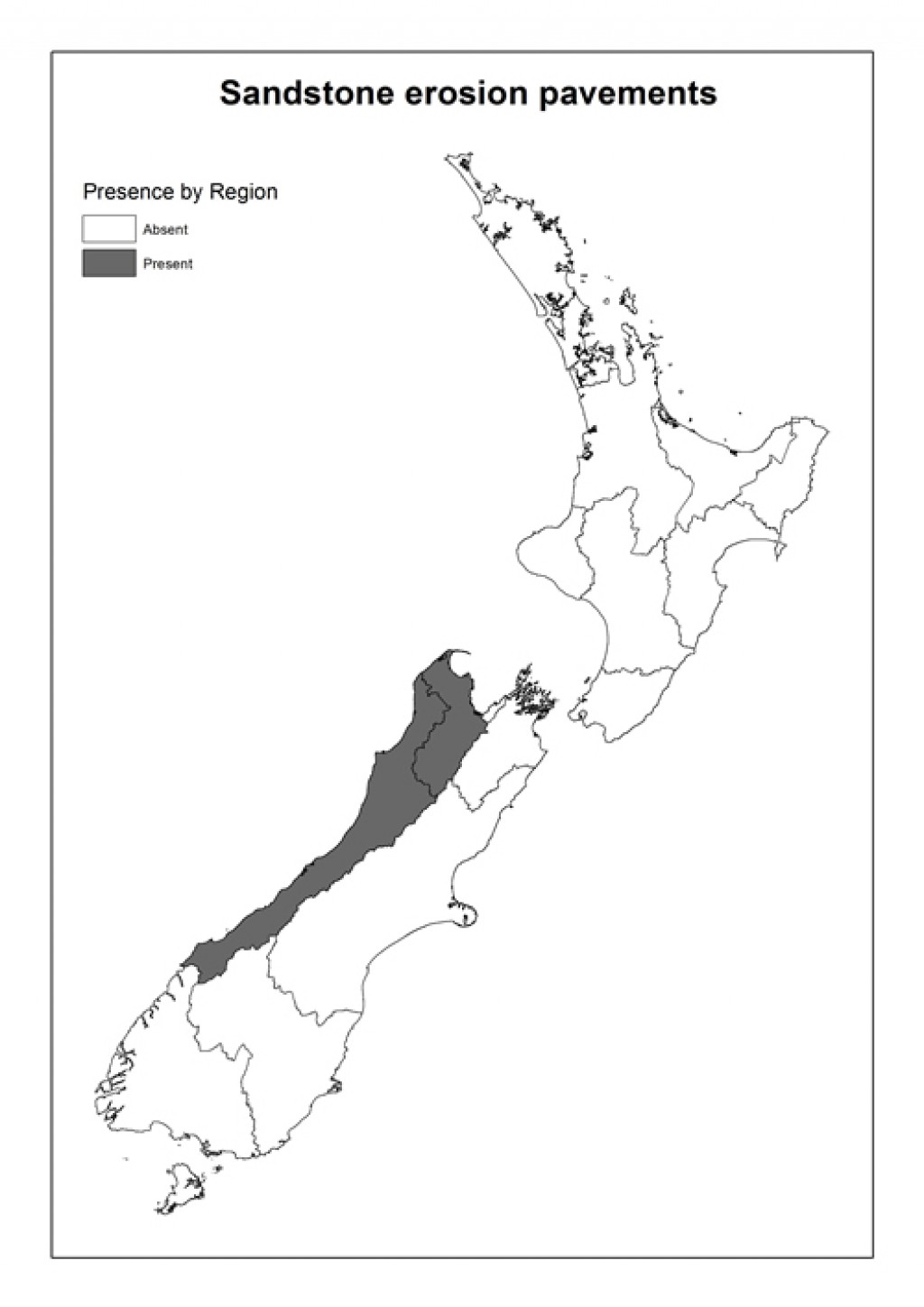
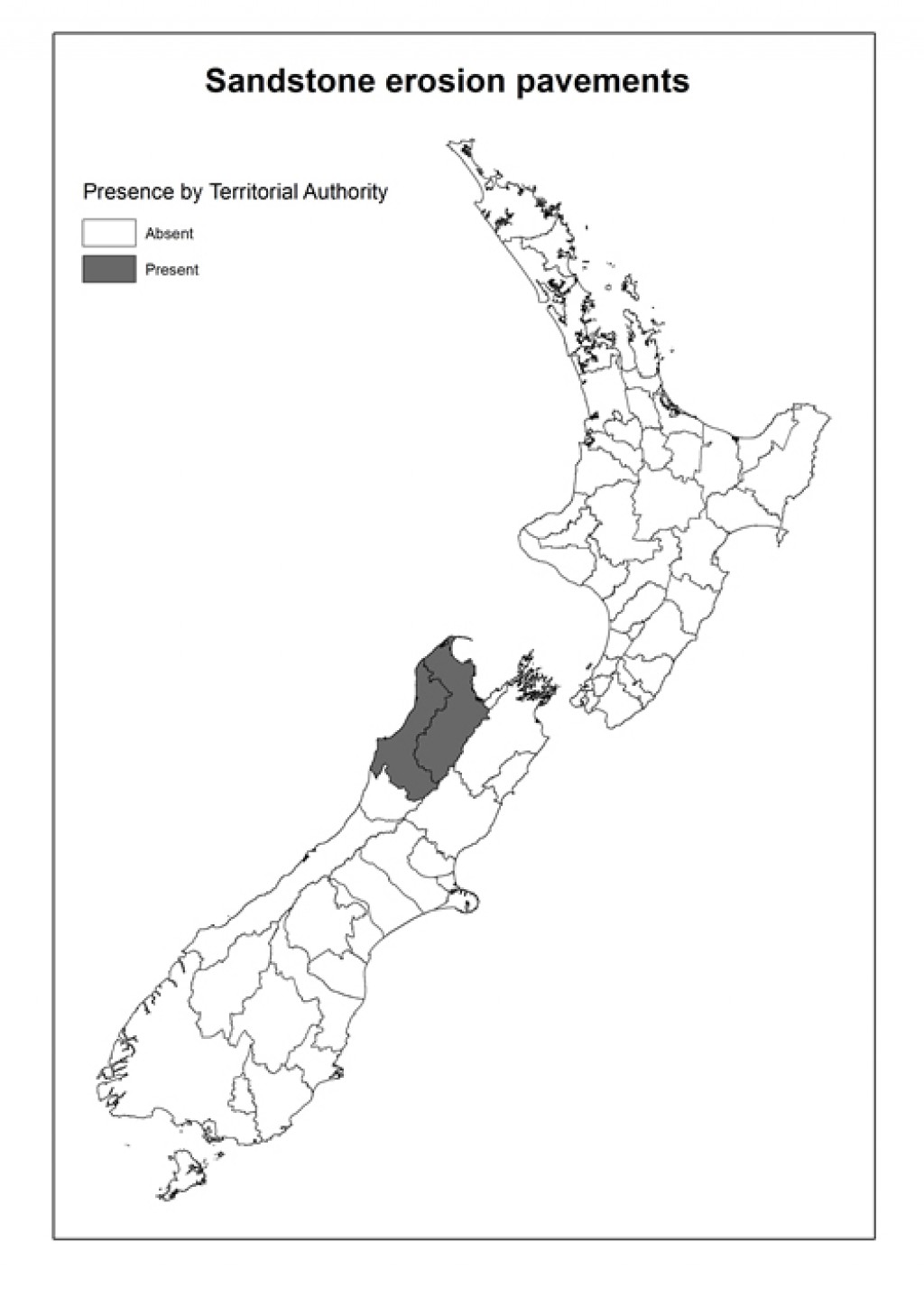
Where do they occur?
Sandstone erosion pavements are known from the coal measures of the Denniston and Stockton Plateaus in Westland, Mt Davy on the Paparoa Range, and on the Herbert Range south of Garibaldi Ridge, North-west Nelson. They have probably increased in area at the first three of these four sites since human settlement, due to grazing and burning.
Further reading
Buckingham RP 2011. Survey for terrestrial fauna at the proposed Mt William north mining area. Report for Solid Energy NZ Ltd.
de Lange PJ, Galloway DJ, Blanchon DJ, Knight A, Rolfe JR, Crowcroft GM & Hitchmough R 2012. Conservation status of New Zealand lichens. New Zealand Journal of Botany 50: 303-363.
Mason R, Moar NT 1955. Notes on the vegetation and the flora of Mt. Augustus, Buller County. New Zealand Journal of Science and Technology 37(A): 175-186.
Nicol RG, Overmars FB 2008. Vegetation and flora baseline survey L & M Coal Ltd Escarpment Mine Project Denniston Plateau. Report prepared for Resource and Environmental Management Ltd.
Norton D. 1997. The hidden coal plateau of the Buller. Forest and Bird, May.
Overmars FB, Kilvington MJ, Gibson RS, Newell CL, Rhodes TJ 1998. Ngakawau Ecological district. New Zealand Protected Natural Areas Programme Survey Report 11. Hokitika, Department of Conservation.
Links
The Black and the Green (New Zealand Geographic)
The Great Buller Coal Plateaux (Leicester Kyle Texts)