A webinar series exploring new technologies that support future action for our environment.
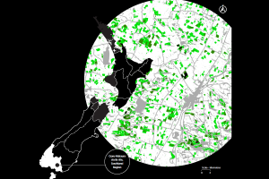
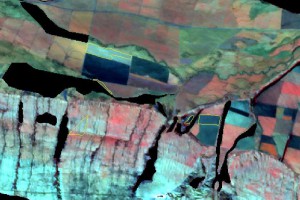
Manaaki Whenua lead the research and development of remote sensing of the terrestrial environment in New Zealand. Working in this space since the 1970’s, it is no surprise that our research teams are at the forefront of developing and implementing cutting edge technologies and methods to monitor and better understand the environment.
At the beginning of May, we launched a mini-series of four webinars over two days to showcase some of the recent developments in remote sensing technologies and how these are applied to answer questions for policy-makers, councils and landowners.
If you would like to join the mailing list for any future events on our remote sensing research, please email events@landcareresearch.co.nz.