- Home
- ...
- Smarter Targeting of Erosion Control (STEC)
- Smarter Targeting of Erosion Control (STEC) News
Getting to the core of the problem: unlocking flood histories in catchments
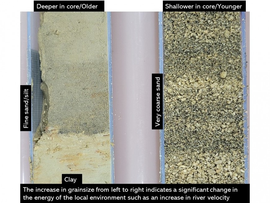
Erosional events, such as landslide-triggering storms, mobilise and redistribute sediment through a catchment, depositing material in riverbeds, banks and floodplains. The deposited sediments have characteristics, namely grain-size, that relate to the energy of the flow in which they were deposited, and the chemical signature of the sediment reflects the sediment source locations (Figure 1). By using the legacy of sediment that has accumulated in floodplains over time, it is possible to evaluate the history of river catchments being studied.
Immy’s project is building on pilot studies completed in 2018 and 2019, in the Whanganui and Manawatū catchments respectively, by STEC research partner Prof. Ian Fuller of Massey University. These pilot studies showed that paleoflood sizes exceeded gauged records, indicating that the risk of extreme flooding is likely to be underestimated and emphasising the need for future research. Through Immy’s prior work in lacustrine environments, she developed an in-depth understanding of the processes governing sediment accumulation and deposition as well as experience developing climate records from sedimentary archives. This has provided a good foundation for her work within the STEC programme.

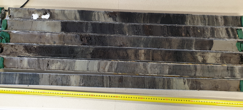
Figure 2: It’s complicated: ITRAX XRF, CT, radiocarbon and particle size analysis data will be used to pull apart the complex stratigraphy seen here. Cores from Atene Bend, Whanganui River.
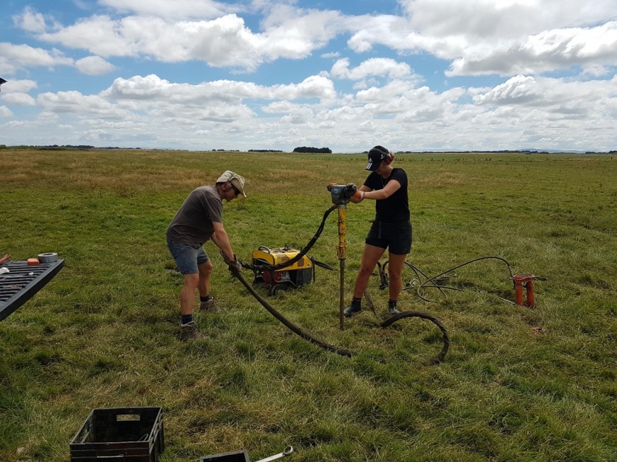
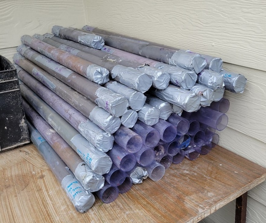
Coring of the Whanganui River at Atene bend was completed in 2020 (prior to Immy’s involvement) with approximately 36 m of core collected (Figure 2). On day 1 of her PhD project in early 2022, she cored the Oreti River with her Massey University supervisors, extracting approximately 25 m of cores from eight coring sites (Figures 3 and 4). Coring of the Manawatū River is expected to take place sometime in 2022.
Immy has been analysing core materials at the University of Otago, using Geotek and ITRAX X-Ray Fluorescence (XRF) core scanners to collect high resolution core images, magnetic susceptibility data and information on the elemental composition of core materials. CT scanning of cores is also being undertaken at Invermay, providing high resolution information on core density.
Immy will use these non-destructive data sets in conjunction with laser diffraction particle size analysis, radiocarbon dating and ICPMS to reconstruct the flood histories of the target catchments.
References
Fuller, I.C., Macklin, M.G., Toonen, W.H., Turner, J. and Norton, K., 2019. A 2000 year record of palaeofloods in a volcanically-reset catchment: Whanganui River, New Zealand. Global and Planetary Change, 181, p.102981.
Fuller, I.C., Macklin, M.G., Toonen, W.H. and Holt, K.A., 2018. Storm-generated Holocene and historical floods in the Manawatu River, New Zealand. Geomorphology, 310, pp.102-124


