Within this great variety, not all soils are equal; some are more versatile than others for supporting food production. Highly versatile soils occur in different locations, such as vegetable production in Pukekohe, dairy in Taranaki and Waikato, citrus in Gisborne, or seed production in Canterbury. Recognising the vital role these soils provide for our export economy, as well as domestic food supply and employment, the New Zealand Government has just released a significant policy to protect the most versatile soils from ongoing urban sprawl and rural residential developments. The National Policy Statement for Highly Productive Land (NPS-HPL) came into effect from 17 October 2022.

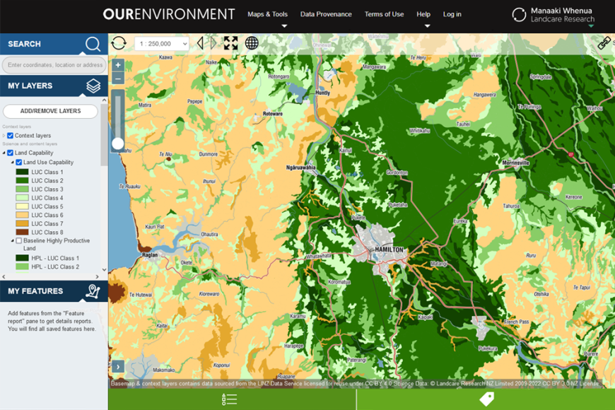
Land use capability (LUC) classes viewed through Our Environment
In New Zealand the capability of different areas of land is evaluated through the Land Use Capability (LUC) classification system, which at its highest classification level assigns areas of land to one of eight LUC classes. LUC class 1 is the most versatile land, whilst LUC class 8 is the least versatile (i.e. conservation or mountain lands). The LUC is widely used to support a number of government policies, from infrastructure and land use planning through to farm management. As such it is recognised as part of the nationally significant databases and collections. Maps of the LUC can be viewed through Manaaki Whenua’s Our Environment website, whilst the complete dataset can be downloaded from the LRIS (Land Resource Information Systems) portal. In order to enable easier access to LUC-related documents and information, a new web portal is expected to be launched by mid-2023.
The NPS-HPL recognises highly productive land as belonging to LUC classes 1 to 3, which in its original state comprised around 14% of New Zealand. However, the Our Land 2021 national state of the environment report highlighted that cumulatively, large areas of HPL have been lost to urban sprawl and rural residential developments, with a significant impact on the past 20 years alone. To monitor the effects of land fragmentation on HPL availability, a new environmental indicator for HPL was developed by Manaaki Whenua in collaboration with the Ministry for the Environment, Stats NZ and Waikato Regional Council. A full description of the land fragmentation indicator is available from Stats NZ. A brief summary of the science underpinning this indicator is available in our Soil Horizons newsletter.
These actions to improve the stewardship of New Zealand’s highly productive land through the NPS-HPL and the land fragmentation indicator require national coverage of geospatial datasets such as the LUC, S-map, the Land Cover Database, and Protected Natural Areas. All of these datasets represent significant public investment, often over generations, that the nation cannot afford to lose. This highlights the invaluable contribution of nationally significant databases and collections to the intergenerational availability of fundamental knowledge about our natural environment.
