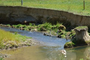
Drone and survey equipment used to survey and measure earthflows within the Tiraumea River catchment.
Researcher Dr Andrew Neverman says understanding what drives the movement of earthflows and how much sediment they contribute to their receiving environments, and when, is key to improving erosion mitigation targeting, and to forecasting changes in erosion and sediment loads under projected climate change.
This is just what a research project under the Smarter Targeting of Erosion Control (STEC) MBIE programme is planning to achieve. “Our aims are to better understand the patterns and hydroclimatic drivers of earthflow movement and also better understand the contribution of earthflows to catchment sediment budgets,” says Andrew.
The research team has deployed a range of sensing technologies over the past 4 years to monitor an earthflow in the Haunui research catchment, situated within the Tiraumea River catchment, Manawatu. “These technologies provide data on sub-daily to multi-year earthflow movement rates, annual changes in earthflow volume, and their hydroclimatic drivers,” says Andrew. “These include IoT sensors (Internet of Things) sensors that gather information remotely and share data in real time) that have been deployed to continuously record meteorological variables (rainfall, wind speed, temperature, humidity), pore water pressure, and earthflow movement.”
Earthflow movement is monitored using a continuously operating GNSS (satellite) receiver, which records its location every 30 seconds, and a network of monitoring pegs that are surveyed annually. Andrew says
“peak earthflow movement rates of 0.25 m per day, and 17 m per year have been recorded during the monitoring period.”
Drones are also used to create surface elevation models of the earthflow. “These are used to estimate the volume of sediment lost from the earthflow,” says Andrew.
He adds that findings show the earthflow becomes mobile when soil pore pressure/soil moisture crosses a threshold, with a period of continuous movement from June to November when pore pressures and soil moisture levels remain high. Heavy rainfall events further speed up the movement.
Andrew says this study suggests the combination of future changes in mean annual rainfall, evapotranspiration (the processes by which water moves from the land surface to the atmosphere), and the frequency and intensity of rainfall will determine how the movement and sediment contribution of earthflows and other shallow slow-moving landslides respond to climate change, which is likely to vary between regions.
Key contact