Case study: Improving water resource management and use to enhance rural livelihoods in Colombia and Ecuador
In this section

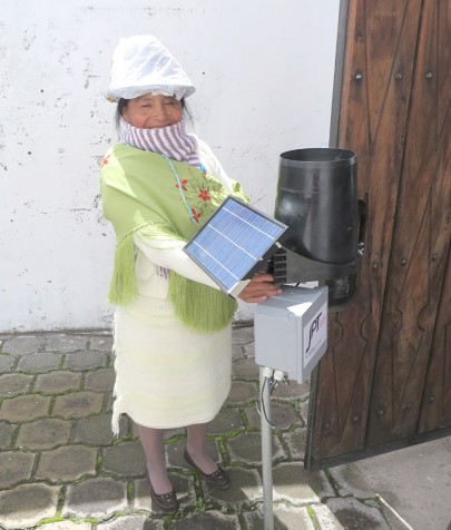
A woman from the Jatarishun community (Ecuador) with one of the project’s original recording rain gauges (now upgraded to more reliable solar charging and connected to the web).
The project, Improving water resource management and use to enhance rural livelihoods in Colombia and Ecuador, was an aid programme that the Manaaki Whenua team led by Andrew Fenemor and Chris Wheatley designed with local NGO partners Corpopalo in Cauca, Colombia, and CESA in Cotopaxi, Ecuador.
New Zealand Ministry of Foreign Affairs and Trade’s Aid programme funded the project, with co-funding from Manaaki Whenua and in-kind contributions from Corpopalo (the Corporation for the Integrated Management and Recovery of the Palo River Basin), the National Association of Industrialists (ANDI), the NASA indigenous community, and the Ecuadorean Centre for Agricultural Services (CESA).
It was an excellent example of a project where integrating the indigenous worldview and applied science improved both local engagement and local solutions.
Manaaki Whenua Senior Scientist Andrew Fenemor (now a research associate) says the goal of the nearly six-year project, which ended in 2021, was to improve rural livelihoods for the largely indigenous communities in these two high-altitude catchments.
“By applying knowledge from locally-generated land and water inventories, communities and agencies are showing real inspiration to improve the way they manage these steep lands and their water use, which in turn is building a sense of community and improving rural livelihoods and incomes.”
The project set up water monitoring networks, developed land suitability plans, kick-started community water governance, and identified local development opportunities compatible with improved water and land management. “A major motivation was for local communities to improve their catchments while protecting upland páramo tussocklands, which generate much of the water needed down-catchment, says Andrew.

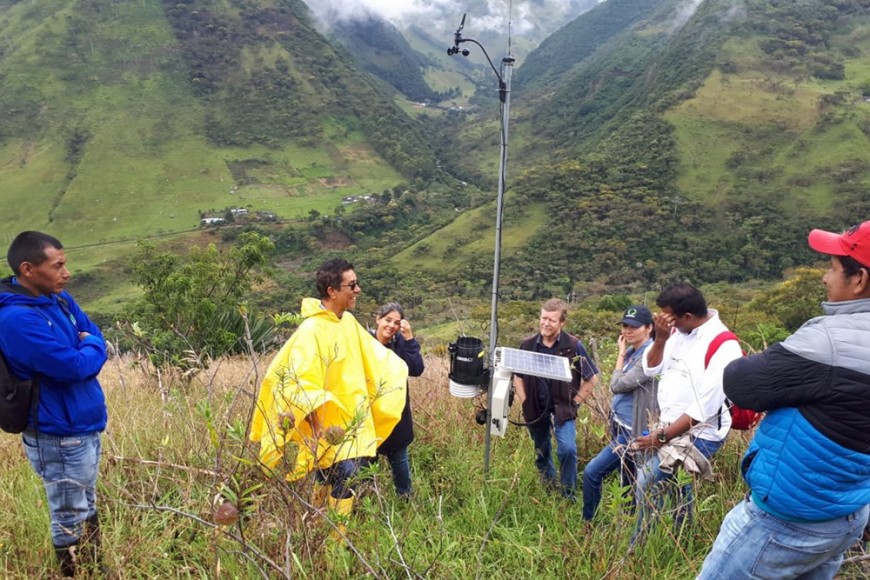
Inspecting newly installed climate station near Toribio with project partners from CorpoPalo, Cenicaña and the local community
As part of the activities, the project established automated rainfall and river flow monitoring networks, completed surveys of water takes and land use, and used satellite mapping to relate landscape attributes to land use suitability.
These catchment inventories are providing the data to work with local communities to facilitate water sharing, reduce contaminant discharges, and improve land sustainability.
The work is already having an impact for communities in the Toribio (Cauca Department, Colombia) and Latacunga (Cotopaxi Province, Ecuador) areas, with the increased attention attracting more funding and activity around water management. There have also been requests to apply this integrated catchment management approach in other catchment areas in both Colombia and Ecuador.

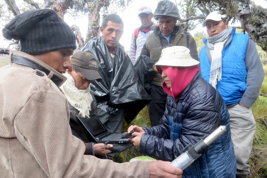
Marcia Chancusig (CESA) with Toacaso community members downloading river level data at a river monitoring site under Volcan Illinizas for planning a water supply scheme.
Andrew says a key to the success of the project was our Kiwi researchers' experience of working with Māori. “There are remarkable similarities in ‘cosmovision’ for the natural environment between Aotearoa New Zealand and Colombian and Ecuadorean indigenous peoples,” he says.
Andrew also praised the two female project managers in the partner organisations who provided inspiring leadership in heavily male-dominated communities and agencies.

