Back in 2013, Essential Biodiversity Variables (EBVs) were proposed as a set of generalised measures of biodiversity, and suitable as a way to track progress towards targets defined by the Convention on Biodiversity, e.g. the Aichi Targets for 2020. EBVs can also provide the foundation for developing biodiversity forecasts under different policy and management scenarios. Widely advocated internationally (e.g. through the Intergovernmental Science-Policy Platform on Biodiversity and Ecosystems Services, IPBES), EBVs fit into broad classes of genetic composition, species populations, species traits, community composition, ecosystem structure, and ecosystem function.
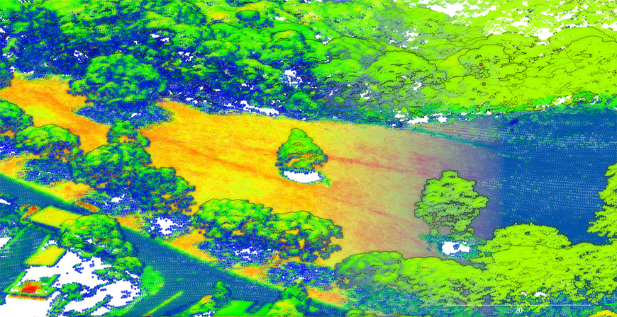
Given our success in mapping entire stands of forest through LiDAR imagery, we have been asking whether the future of biodiversity monitoring could be through remote sensing. We’ve found that some species populations’ data can be obtained by this method, along with the trait of phenology (where changes can be picked up visually). However, ecosystem structure is the EBV that shows most promise for remote approaches, through live cover fractions and ecosystem distribution/vertical profiles. Once individual trees can be identified to species level, carbon estimates can also be derived, assuming that wood density has already been established in situ.

LIDAR mapping of individual trees in central Wellington.
The future looks bright as we continue to develop this technique for monitoring ecosystem structure. The work is being helped by a major collaboration between Manaaki Whenua, Scion, two Singaporean research institutes, the University of Canterbury and Victoria University of Wellington. The programme, one arm of which is being led by Manaaki Whenua’s Dr Jan Schindler, is using data-science methods to extract tree species information from multi-resolution remote-sensing data to model tree species and their interactions with the environment. The programme even aims to quantify the socio-economic effects of trees.

