Emily McKay mapping soil in the Coromandel.
Pedologist Emily McKay who conducted fieldwork in Northland with Senior Researcher Dr Scott Fraser reported back that the soils in the region were “highly interesting, incredibly variable, and can be really hard to dig!”
“We encountered the famous Kerikeri Oxidic soils, and Allophanic soils formed on young basalt flows, both really valuable for horticulture,” says Emily. “The most interesting feature so far among many of the Ultic and Podzol soils is the presence of a silica-rich layer that makes your auger squeak and spin in circles, and are some of the most difficult soils for farmers to manage.”
“We encountered the famous Kerikeri Oxidic soils, and Allophanic soils formed on young basalt flows, both really valuable for horticulture,” says Emily. “The most interesting feature so far among many of the Ultic and Podzol soils is the presence of a silica-rich layer that makes your auger squeak and spin in circles, and are some of the most difficult soils for farmers to manage.”
Meanwhile, other researchers collecting data for the most recent S-map update didn’t let a little thing like a late spring snowfall stop their important work. Lincoln-based pedologist Balin Robertson soldiered on in the snow down in Mokoreta in Southland to collect his soil samples.
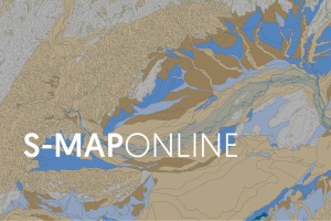
Developed and updated by Manaaki Whenua, S-map provides the best available soil survey data for AoNZ. Displaying basic soil property data like depth, stoniness, and clay content, as well as more complex data like water-holding capacity and nitrogen leaching risk, S-map provides comprehensive and accurate soil information to support sustainable management of our soil resource. There are also tools that help land managers and consultants find the S-map soil type that best matches on-farm field observations.
Soil scientist Dr Sam Carrick says richer soils data mean much better modelling assumptions, which in turn support better decision-making on the ground. “A major focus has been on provision of soil hydrology information, soil attributes that have significant effects on farmers’ nutrient budget calculations,” says Sam. “More accurate soil moisture information will lead to better knowledge of irrigation demand and nutrient losses.”
The new mapping in the most recent release includes nearly 80,000 ha on Banks Peninsula in Canterbury, 143,000 ha in the Catlins region of Otago and nearly 60,000 ha from Waitara to Hāwera in the Taranaki.

Balin Robertson collecting soil samples by auger in Mokoreta, Southland.
Mapping has also been upgraded for the Awatere Valley in Marlborough, Eltham in Taranaki, and approximately 170,000 ha covering the Rotorua Lakes catchment and north to the coast between the Kaituna River and the Pikowai Stream in the Bay of Plenty.
Sam says advances to S-map data have led to its extensive adoption in farm environmental planning, monitoring, and reporting. In addition to the popular S-map Online website, data are supplied directly to an expanding list of Agri-service business tools including those used by fertiliser companies, dairy companies, most regional councils, and banks. S-map data are a critical input in the NZ Water Model (NIWA), the Agricultural Production Systems Simulator crop model (Plant & Food Research and AgResearch), IrriCalc (Aqualinc) and the OverseerFM nutrient budget tool.
“These tools provide critical information to public organisations, farmers and the agri-service sector across Aotearoa New Zealand,” he says.
Additionally, S-map data are used by scientists for erosion, crop production, nutrient management, irrigation, and other hydrological research. Regional councils rely on S-map in the development of regional plans focused on water quality and consenting for water takes.
“Through a collective multi-agency collaboration we have put a large effort into developing easily accessible land resource assessment capability for New Zealand,” says Sam. “S-map Online usage continues to grow, with more than 27,000 registered users downloading 51,000 soil factsheets every year.”