Human impacts and ecological transformation
Determining initial human impacts on New Zealand ecosystems, the anthropogenic transformation of vegetation by fire, and the timing and impact of faunal extinctions.
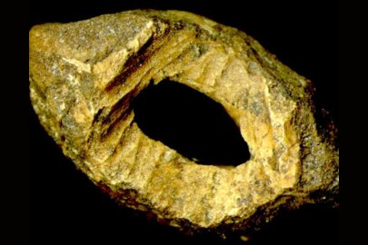
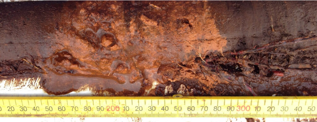
 Prehistoric ecological impacts of Pacific rat
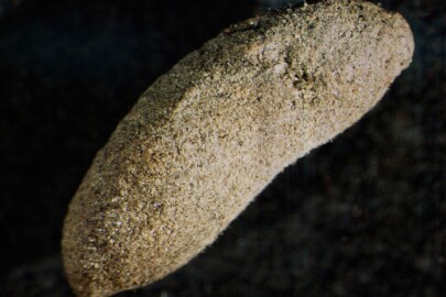
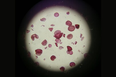
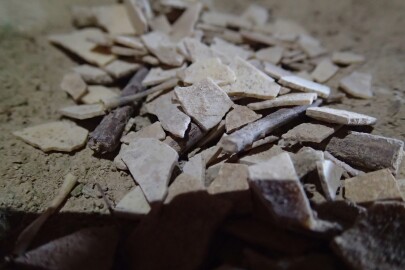
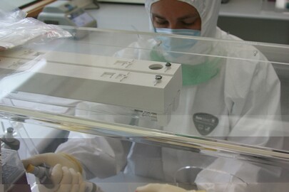
Using newly discovered coprolites to study the diets of New Zealand's first invasive mammal
Our team will study aDNA, pollen, seeds, feathers and parts of invertebrates and plants from newly discovered kiore (Pacific rat) coprolites (preserved dung) found in rock crevices in Central Otago. We will also seek out other sites of kiore coprolites in the North and South Islands.
The kiore was the first and only exotic mammal to naturalise in New Zealand in the 500 years before European settlement. With the discovery of these coprolites the complete history of a rat invasion can be reconstructed, right back to the kiore’s arrival with Māori in the 13th century.
By analysing DNA in ancient kiore dung, we will find out what these invasive rats were feeding on (e.g. birds, reptiles, amphibians, invertebrates, plants). Radiocarbon dating will reveal how the diet of these rats, and their impact on vulnerable animals and plants, changed over time.
Other questions addressed will include what the role kiore played in seed predation and dispersal, and whether rat predation contributed to the extinction of large animals such as the moa.
This project will provide a global benchmark for understanding prehistoric island invasions and rat impacts on a pristine island ecosystem.
 Tracking past human impact on islands by improving palaeoecological reconstructions with PalEnDNA analysis
Revealing the past occurrence of “ghost taxa” and unlocking past records from “silent sites”
Island ecosystems host a significant proportion of global biodiversity, but their rich insular biotas are also more vulnerable and less resistant to novel pressures than continental biotas. Human colonization has been a relatively recent event on most islands globally, and has nearly always resulted in devastating losses of biodiversity.
The Canary Islands were no exception; these oceanic islands were colonized by aborigines more than 2000 years ago and later by Europeans, and have been transformed since this time. Despite being one of the most biodiverse regions within Europe and a target for EU biodiversity policies, there is a key knowledge gap about the pre-human state and natural variability of unmodified Canarian ecosystems that could help planners and managers to guide their strategies. This makes the Canaries the perfect place to reconstruct baseline ecosystem states and the long-term impacts of human activities.
ISLANDPALECO will assess the timing and extent of human impact on Canary Island ecosystems by providing detailed reconstructions of past environments, combining innovative and conventional palaeoecological tools and integrating the results in conservation ecology and management strategies. One of the main difficulties in the implementation of palaeoecological techniques in the Canaries is to detect fossils. This is due to poor conditions for fossil preservation at certain sites, i.e. “silent sites”, and under-representation of several key taxa, such as Lauraceae, in the fossil record, i.e. “ghost taxa”. The analysis of ancient DNA (aDNA) from palaeoenvironmental samples, defined as palaeoenvironmental DNA (PalEnDNA), provides a novel complementary tool to traditional palaeoecological proxies.
The main aims of ISLANDPALECO are:
- to improve the reconstruction of past environments in the Canary Islands by revealing the past occurrence of “ghost taxa” and unlocking past records from “silent sites”. This will be by means of PalEnDNA analysis combined with traditional tools in palaeoecology;
- to assess the timing and extent of human impact on Canarian ecosystems following the two waves of human colonization, based on new and existing improved palaeoenvironmental reconstructions, providing pre-human vegetation baselines, and related post-(aboriginal)colonization and post-(European)contact vegetation responses; and
- to communicate the results from ISLANDPALECO to both scientists and managers so that palaeoecological information can be easily incorporated into ecological restoration and conservation, and disseminated to the society via scientific, academic and popular media.
This will be the first time that PalEnDNA analysis will be implemented in the Canaries and probably one of the few cases on islands, becoming a valuable benchmark example of the applicability of PalEnDNA analysis in other island regions. This project has received funding from the European Union’s Horizon 2020 research and innovation programme under the Marie Skłodowska-Curie grant agreement No 700952.
 Dating the prehistoric Moriori settlement on Rekohu (Chatham Islands)
Exploring an anomoly in the settlement timing of East Polynesia
The broadly accepted date for the initial human settlement of Rekohu (Chatham Islands) by Moriori is AD1500: a striking 250 years later than New Zealand and other East Polynesian islands. Is this late settlement an anomaly given the dearth of evidence for prolonged inter-island voyaging post-discovery? Or is it merely a result of limited radiocarbon dating of robust sample materials?
This project aims to use radiocarbon dating of sediment records and museum materials to examine past vegetation and faunal changes to provide a new overview of the cultural and ecological changes associated with initial Moriori settlement. We hope to solve one of the last remaining puzzles in the timing and pattern of New Zealand prehistory and of the broader East Polynesian diaspora.
 Fire in New Zealand ecosystems
Understanding increased fire frequencies following human settlement as a novel driver in New Zealand ecosystems
Besides being essential for heating and cooking, fire has always and everywhere been the primary tool for clearing unwanted vegetation. Prehuman New Zealand was one of the few regions on the globe where natural fire played an insignificant role.
Our native trees and shrubs are, with few exceptions, highly vulnerable to fire and only a very limited range of native plants (e.g. manuka, matagouri, bracken and tussock) are favoured by repeated burning.
The widespread burning that accompanied the first settlers in the 13th century was therefore devastating. Much of what had been a largely forest-covered land was transformed into a patchwork of scrub, grassland and forest.
The fire-driven deforestation of New Zealand was unparalleled for its speed and completeness. Our research interest centres on explaining how and why it happened, and what the implications are for how we manage our post-fire landscapes. Globally, fire is now recognised as one of the major drivers of landscape and vegetation change and there is intense interest in understanding its fundamental dynamics.
 Dating the initial arrival of humans on pristine island ecosystems
Establishing the timing and sequence of events in the human settlement of new landmasses is key to understanding drivers of ecological impact
The last major prehistoric dispersal of modern humans occurred with the discovery and settlement of the remote and scattered islands of East Polynesia. This remarkable episode included the colonisation of more than 500 tropical, subtropical, temperate, and subantarctic islands comprising 289,000 km2 of land scattered over 20 million km2of ocean.
Previous work dating woody seed cases of native trees with distinctive chew marks made by the introduced commensal Pacific rat showed that New Zealand could not have been settled any earlier than the middle of the 13th century. The Pacific rat spread with voyaging humans in the Pacific region, therefore its earliest presence indicates initial human contact. Analysis of a huge database of published radiocarbon dates from archaeological sites throughout the eastern Pacific has shown that New Zealand was settled not late or early relative to other islands in this region, but at virtually the same time as the rest of East Polynesia.
Over 1400 radiocarbon dates from 14 East Polynesian archipelagos were analysed to show that initial prehistoric colonsation from Tonga-Samoa was earliest in the Society Islands c. AD1025-1120; centuries later than previously assumed. It then dispersed to all the remaining island groups, which were settled in less than a century of each other, between c. AD1200-1290. Only radiocarbon dates based on the most reliable dating material (charcoal and twigs from short-lived plants, seeds and leaves) were used to make this robust conclusion.
A precise time for initial settlement on an island is important to determine as it provides the starting point for establishing the rate of ecological and cultural change following the arrival of humans and their introduced commensals.
Conservation palaeoecology
Reconstructing the ecology of extinct and introduced fauna; establishing vegetation baselines; providing relevant data to improve understanding of remaining biota.
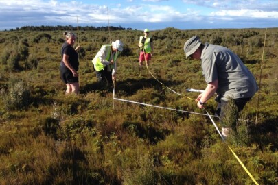
Figure 2. Setting up sampling plots on a restiad bog, Awarua, Southland.
Wetland Assessment and Monitoring Tool (WAAM)
Pre-human baselines for assessing, monitoring and restoring New Zealand’s wetland ecosystems
Wetlands in peril
New Zealand wetlands provide ecosystem (e.g. water quality, recreation), biodiversity (e.g. threatened species) and cultural (e.g. mahinga kai, weaving fibres) services valued at $US40–50,000 ha/p.a.. However, more than 90% of wetlands have been destroyed since initial human settlement, reducing wetland coverage to just 1% of NZ’s land area. Protecting remaining wetlands and their values is a recognised priority internationally, as well as nationally, and in 2014 more than 132 individual community-led projects were actively attempting to restore 896 ha of NZ wetlands. However, efforts to prioritise, manage and report on wetlands are constrained by current monitoring methods, which only consider a narrow range of ecosystem, biodiversity and cultural services and a historical context based only an expert estimate of the 1840 AD wetland condition.
Our aim
Over the next three years (2017-2020) we will develop a tool for ‘wetland assessment and monitoring’ (WAAM) that:
- provides historic baselines to guide management and protection of wetland ecosystems, and restoration of mahinga kai and other culturally significant taonga species
- assesses current wetland condition in relation to historic baselines from which state-changes trajectories and tipping points can be identified, modelled and managed
- allows DOC, iwi, QEII, regional councils and others to monitor land-use impacts and prioritise restoration efforts
- advances MfE’s State of the Environment reporting and makes progress towards their long-term target that ‘Freshwater ecosystems are healthy and resilient to pressures’
- supplies attributes for future inclusion of wetlands in the National Objectives Framework for freshwater management, assisting regulators to measure progress.
How will we do this?
Wetlands are dynamic ecosystems, and determining the ‘naturalness’ of a wetland relies on a deep understanding of how its current state sits against its long-term variability in key factors such as hydrology and biological community composition (Fig. 1). Current approaches to defining wetland condition either fail to consider the long-term context, or else use an arbitrary time point (e.g. 1840 AD) to estimate a ‘natural’ reference state. We therefore hypothesise that current wetland condition metrics correlate weakly with the degree of modification of wetlands from their range of natural (pre-human) states.
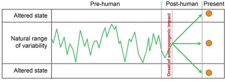
Figure 1. Wetland condition is currently determined solely from its present state (circles). However, translating this into ‘naturalness’ relies on a long-term baseline of natural variability (green line) against which trajectories following perturbations (e.g. human impacts) can be assessed. The WAAM tool will provide this context, allowing robust ranking of wetlands for conservation prioritisation, and informing on the relative cost/effort required to restore a wetland to a ‘natural’ state.
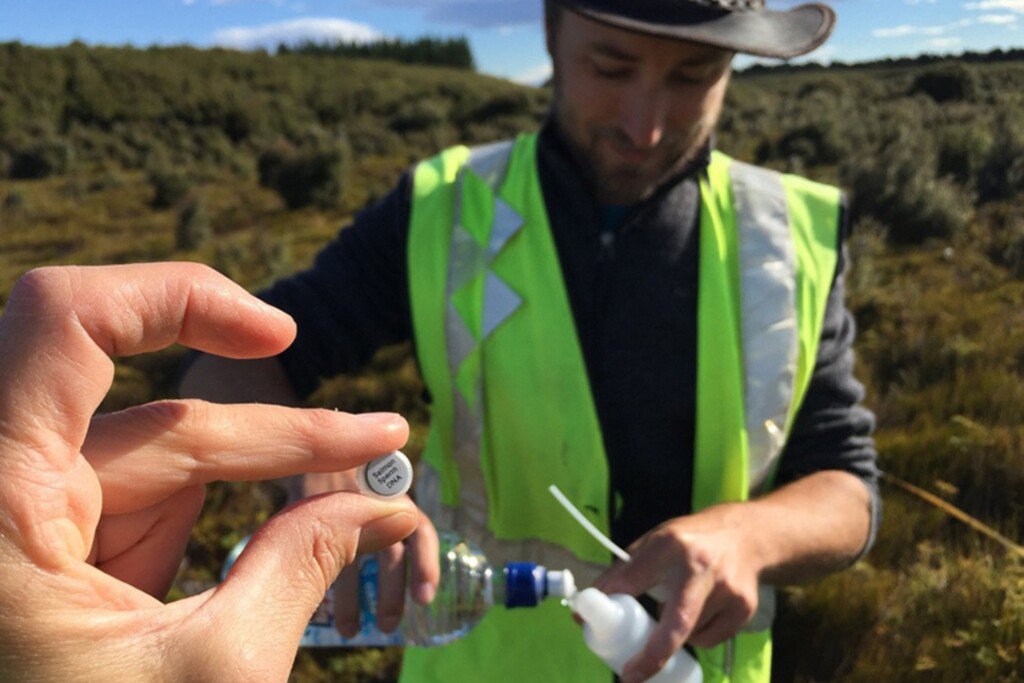
We will test this hypothesis by comparing present wetland ecosystems with their past states. Our approach of using past wetland condition to enhance monitoring and management is a global first. The innovative use of leading-edge palaeoecological methods (aDNA, charcoal, ITRAXTM core-tracker) and whole biotic community reconstruction represents a novel approach to defining current wetland condition.
By developing new indices for wetland condition based on newly-available statistical techniques that consider the full range of natural variability rather than single baseline states, we will make conceptual advances in the quantification of changes in multivariate composition and extend the potential for palaeoecology to inform and guide ecosystem restoration.
Our palaeoecological-based measure of wetland condition will include a robust sampling strategy that addresses the spatial heterogeneity of palaeoecological proxies within wetlands, and will be applicable to all wetland types. Moreover, it will allow the identification of indicator taxa for wetland condition that will underpin future eDNA-based monitoring of wetland sites.
With specific focus on tracing DNA from culturally-significant taxa (to be determined in consultation with local iwi) our proposal will incorporate Māori-specific interests by: 1) establishing historical contexts for taonga species and mahinga kai, 2) enhancing habitat quality for mahinga kai, and 3) providing a monitoring tool to support economic harvesting of mahinga kai.
 Defining New Zealand’s lost avifauna
Establishing baselines for understanding the evolution of New Zealand’s biota and the impacts of human settlement
The caves, swamps and sand dunes of New Zealand hold one of the most complete late Quaternary terrestrial vertebrate fossil records globally. As a result, the composition of New Zealand’s prehuman (>750 yr BP) avifauna is relatively well-known. However, our understanding of the phylogenetic relationships of many of the extinct species remains unresolved.
Using a combination of traditional morphological analyses and ancient DNA hybridisation enrichment techniques, we are currently reassessing several of New Zealand’s extinct bird species to better understand their evolutionary and ecological histories.
Recently completed projects include the Chatham Island duck and Chatham Islands parrot, and current projects include the New Zealand wrens, laughing owl and New Zealand ravens.
 Prehuman vegetation baselines for restoration
Determing what was here before, to help guide restoration for the future
Islands play a key role globally in the conservation of endemic species. Many island reserves have been highly modified since human colonisation, and their restoration and management usually occur without knowledge of their prehuman state.
However, conservation palaeoecology is increasingly being recognised as a tool that can help to inform both restoration and conservation of island reserves by providing prehuman vegetation baselines. For example the pollen-based reconstructions can help to determine the likely rates and directions of successional changes that have occurred in the past; they can help to determine whether natural rates of succession are preferable to more costly replanting programmes; and they can provide species lists from the island’s long history if restoration replanting is desired.
Our work in this area is currently focused on offshore islands of northern New Zealand, working with local conservation trusts.
Long-term ecological change
Reconstructing vegetation and climate change in New Zealand since the last glaciation, vegetation change on subantarctic islands, and developing an interoperable palaeoecological database called QUAVONZ (Quaternary Vegetation of New Zealand).
 QUAVONZ: Quaternary Vegetation of New Zealand
Establishing a database for New Zealand’s vegetation history over the past 50,000 years
New Zealand’s vegetation communities have undergone significant changes in composition and distribution during the past 50,000 years. These changes have culminated in the widespread loss of forests and expansion of grasslands following human settlement. The history of vegetation change and fire is recorded by pollen grains, seeds, ancient DNA and charcoal preserved in swamps, lakes and bogs. Hundreds of these palaeovegetation records exist from across New Zealand, but are often difficult to locate in the scientific literature, or exist only as unpublished files, in ageing file formats, or on storage media that are fast becoming obsolete. Collation and preservation of these data are therefore of high necessity.
In order to address these issues, we are developing a databank and associated online interface for the collation and visualisation of data relating to the vegetation of New Zealand during the Quaternary (with a main focus on the past 20,000 years) (QUAVONZ: Quaternary Vegetation of New Zealand). The databank will allow contributors to log on, upload files and metadata, manage their datasets, and set security levels. This will ensure the data are protected for the future and available for easy access. The public online interface will use unrestricted data from the databank, and allow users to query records for particular locations, plant taxa or time periods of interest. A key use will be informing landowners of appropriate plants for native vegetation planning for restoration. Users will also be able to create customised diagrams, maps and animations, and if further details are required (e.g. for research purposes or publication) to apply to contributors for access and permission to use raw datasets.
Currently we have a PhD student Jacqui Vanderhoon (started in 2022) helping with this project, and her research questions from the pollen data are focussed on better understanding pollen representation and identifying missing taxa from the pollen record and how we can account for these and improve our understanding of long term pollen records from New Zealand.
 Refining statistical sightings models for inferring event timings in palaeoecological records
Modelling prehistoric extinction and introduction events using Bayesian analysis of radiocarbon dates
Rigorous interpretations of radiocarbon-dated remains, such as bones or rat gnawed-seeds, are key to determining the timing of prehistoric extinction, introduction, and human settlement events. However, the oldest (for introductions/settlement) or youngest (for extinctions) dated specimens will unlikely reflect the true age of the event being dated. A window of invisibility will exist between the true age of the event and the nearest dated specimen relating to it.
Sightings models are a statistical means by which the actual age of an event can be predicted using associated radiocarbon-dated specimens. So far we have refined existing sightings methods for application to relatively recent events, including the initial human settlement of New Zealand and subsequent extinction of moa.
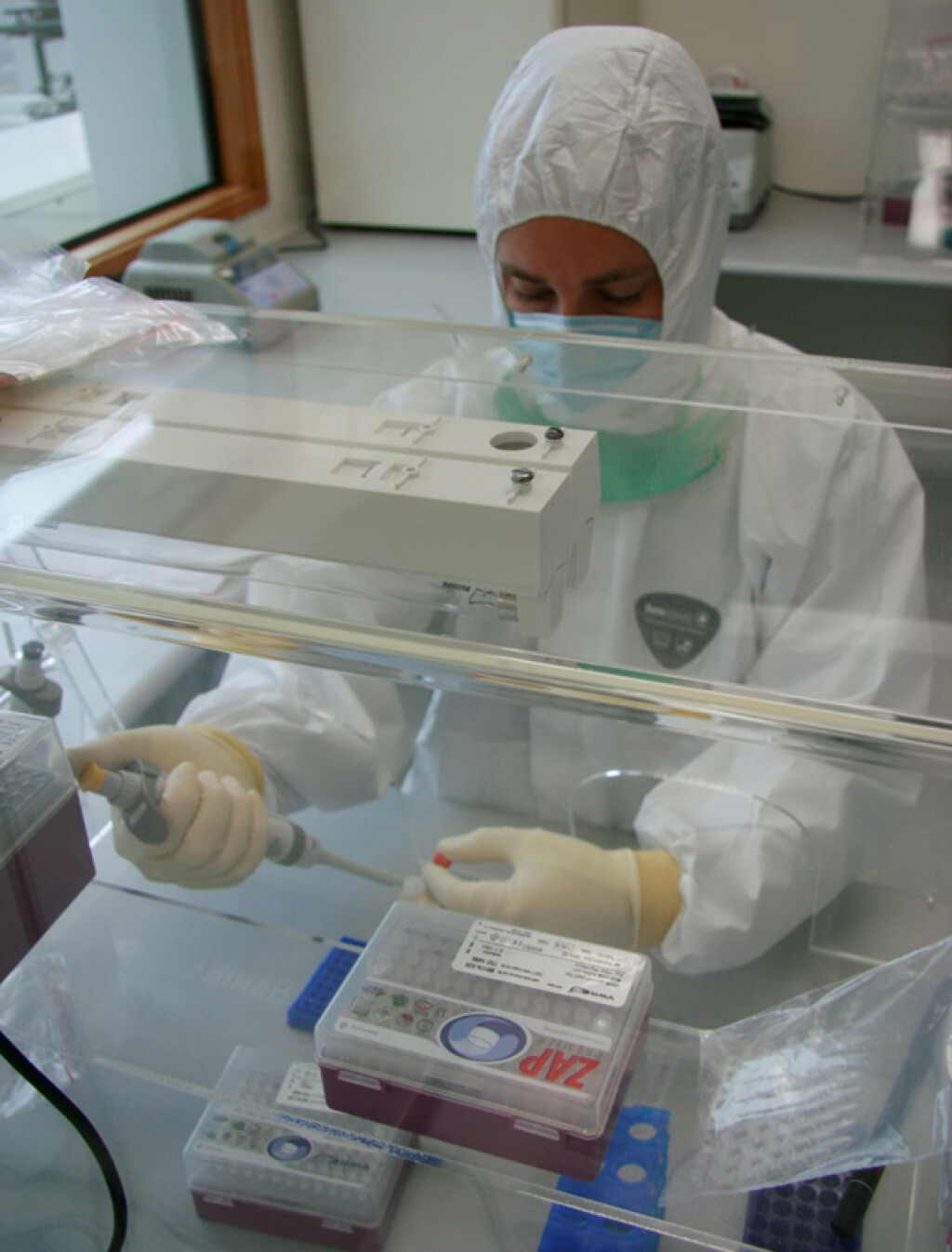
 Resolving ‘ghost’ diversity in pollen records
Increasing our ability to resolve under-represented plant taxa in pollen records
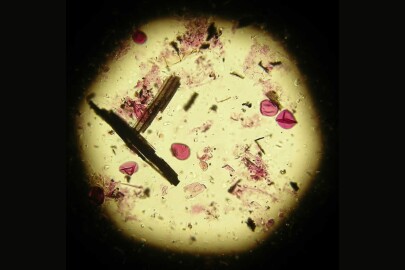
Pollen analysis is a key technique for examining past changes in vegetation communities. However, the pollen grains of different plant species within some genera or families are largely indistinguishable from each other (e.g. Poaceae, Fuscospora, Coprosma) leading to a large amount of dark diversity that cannot be resolved using traditional microscopic techniques. In New Zealand, for example, pollen is only able to detect at most c. 12.4% of the seed-plant diversity (236 pollen types can be identified compared with 1896 native seed-plant species).
We are currently developing techniques for extracting and sequencing ancient DNA from pollen grains. By using primers developed for each broad pollen type we are able to identify pollen grains with a higher degree of taxonomic resolution, allowing deeper insights into past changes in plant community composition. This approach also allows ancient DNA from plants to be assessed in a secure stratigraphic context, overcoming potential issues around DNA leaching through sediment profiles which can afflict bulk-sediment analyses in temperate regions.
In addition to the indistinguishable pollen types found in some plant Families, another common problem with pollen analysis is the under-representation of plant taxa in the pollen record -such as Lauraceae - these are species that rarely get recorded. We are trying to reconstruct the Holocene history of some key "ghost taxa' using modelling approaches.
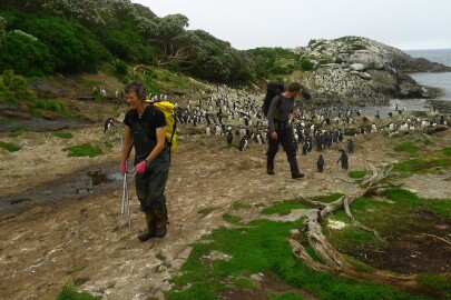 Long-term vegetation and climate history of the subantarctic islands
Assessing ecological change on New Zealand’s subantarctic islands since the last glaciation
The Landcare Research palaeoecology group have a long history of research on the vegetation and climate dynamics of the subantarctic Snares, Auckland and Campbell islands stretching back to the 1950s.
Our work has included studies of soils, vegetation, birds, insects and introduced plants and animals. We are the custodian of a record of vegetation change on Campbell Island in the form of repeat-remeasured vegetation plots and photo-points, as well as numerous archived peat cores, surface samples, and tree ring cores taken from the islands during three expeditions (1994, 1999 and 2013).
Current analyses of peat cores, tree ring cores and vegetation plots are underway to understand:
- vegetation change in response to past climates
- tree line ecotones in relation to plant functional traits
- tree ring analyses in relation to treeline and recent climate change
- the timing of establishment and process of invasion by the tree daisy (Olearia lyallii) on the Auckland Islands
- the timing and spread of peat development on Campbell Island
- detecting prehistoric and historic human impacts on the islands