What data make up LRIS?
The core data of LRIS are:
- New Zealand Land Resource Inventory (NZLRI) and Land Use Capability (LUC)
- Fundamental Soil Layers (FSL), which contains spatial information for 16 key soil attributes
- National Soils Database and other soils data in the National Soils Data Repository (NSDR). This contains full and partial profile descriptions and laboratory analyses.
There is also a suite of other geospatial layers which form part of LRIS but are not officially recorded as part of the nationally significant database. These include the Land Cover Database of New Zealand (LCDB), and the underlying data layers of the Land Environments of New Zealand (LENZ) data set.
What else does LRIS contain?
LRIS also includes a large variety of land resource information in hard copy (annotated aerial photos, oblique photos, card files, and maps) and digital form (satellite images, photos, documents such as field survey sheets), derived data sets, and an associated suite of software, used to create pipelines for data ingestion, processing, generating derivative and integrative interpretations, and data publication.
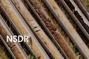
Also associated with LRIS is the National Soil Archive, containing nearly 39,000 physical soil samples from sites in New Zealand, the Pacific, and Antarctica. Most of the data measured from the specimens are stored in the NSDR.
How is LRIS used?
Data and information products are published through a suite of web applications and online services (scroll down to see a list of these). Users of LRIS are very broad and include scientists, government, business, iwi and hapū, universities, schools and the general public both in New Zealand and from overseas.
The LRIS Programme provides data, mapping, and information reports that support:
- environmental reporting (e.g. Environmental Reporting Act), particularly land domain reports
- the design and evaluation of policy intervention (e.g. National Environmental Standards for Plantation Forestry, National Policy Statement for Freshwater Management, the National Policy Statement for Highly Productive Land)
- regional policy analysis and planning (e.g. Resource Management Act)
- implementation of resource management regulations (e.g. catchment limit-setting under the National Objectives Framework)
- land management decision-making and investment (e.g. landowners’ farm planning, farm consultants, catchment conservation work, banking, and insurance industry)
- S-map and services that use S-map data (e.g. the Overseer nutrient budget model).
The LRIS data infrastructure also supports S-Map Online , a website for viewing soil maps and fact sheets created from S-map data. (S-map is the digital soil map unit database of New Zealand).
Staff involved in the LRIS Programme also undertake related research and development, outreach and national and international engagement.
The LRIS Programme operates a helpdesk to answer inquiries from Manaaki Whenua staff and external users on the use of the LRIS services and web applications and also LRIS data. You can contact the helpdesk by emailing lris@landcareresearch.co.nz