Kunzea ericoides - Cyathea dealbata – (Leptospermum scoparium) / Leucopogon fasciculatus - (Coprosma rhamnoides) forest and tall shrubland
Common name: Kānuka forest and tall shrubland
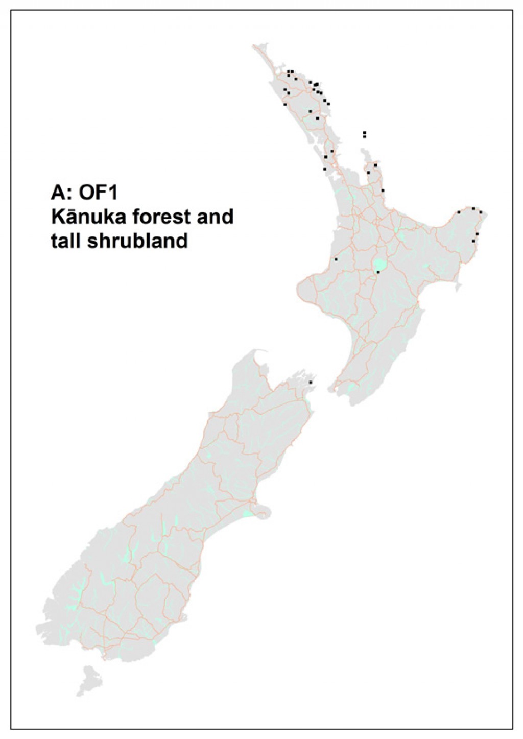
Code: A: OF1
Where does it occur?
This alliance occupies 393 000 ha, primarily north of 39°S and in scattered locations elsewhere on North and South islands. It occurs in lowland areas from sea level to 500 m. Mean annual temperatures are the highest of any alliance (average 14.1 ± 0.19° C).
Description
The forest is dominated by Kunzea ericoides, typically with an understory of Coprosma rhamnoides, Leucopogon fasciculatus, Geniostoma rupestre, and Cyathea dealbata.On some sites Leptospermum scoparium co-dominates.Diagnostic species include Doodia australis, Oplismenus imbecillis, the exotic weed Ageratina riparia and Kunzea ericoides.

A: OF1. Size structure of canopy dominants.
Important species on the ground layer are bracken, Uncinia uncinata, Oplismenus imbecillis, Blechnum novae-zealandiae, Dianella nigra, Microlaena stipoides, Lotus pedunculatus and occasional Doodia australis. Species richness is moderate with on average 41 species per plot, with 17 of these being measurable trees. Exotic species are prominent (averaging 19 ± 2.4% of total species richness), the most frequent being Lotus pedunculatus, Cirsium vulgare and Prunella vulgaris.
Indicator species
Co-occurrence of Cyathea dealbata, Doodia australis and Kunzea ericoides.
Stand characteristics
| Mean canopy height (m): | 11 m (range 8–15) |
| Mean stem density (stems/ha): | 4575 (363) |
| Mean basal area (m2/ha): | 28 (1.7) |
Synonyms
| Relationship | Name | Author |
|---|---|---|
| overlaps with | Kanuka scrub | Singers & Rogers (unpublished) |
| overlaps with | Manuka-kanuka scrub | Singers & Rogers (unpublished) |
| overlaps with | Bracken fernland | Singers & Rogers (unpublished) |
| includes | Kanuka-manuka heaths: Kanuka and mānuka heath on dry sites | Wardle (1991) |
Component Associations
Kunzea ericoides – Cyathea dealbata – Geniostoma rupestre – Melicytus ramiflorus / Coprosma rhamnoides – Leucopogon fasciculatus forest
Common name: Kānuka – silver fern – hangehange – mahoe forest
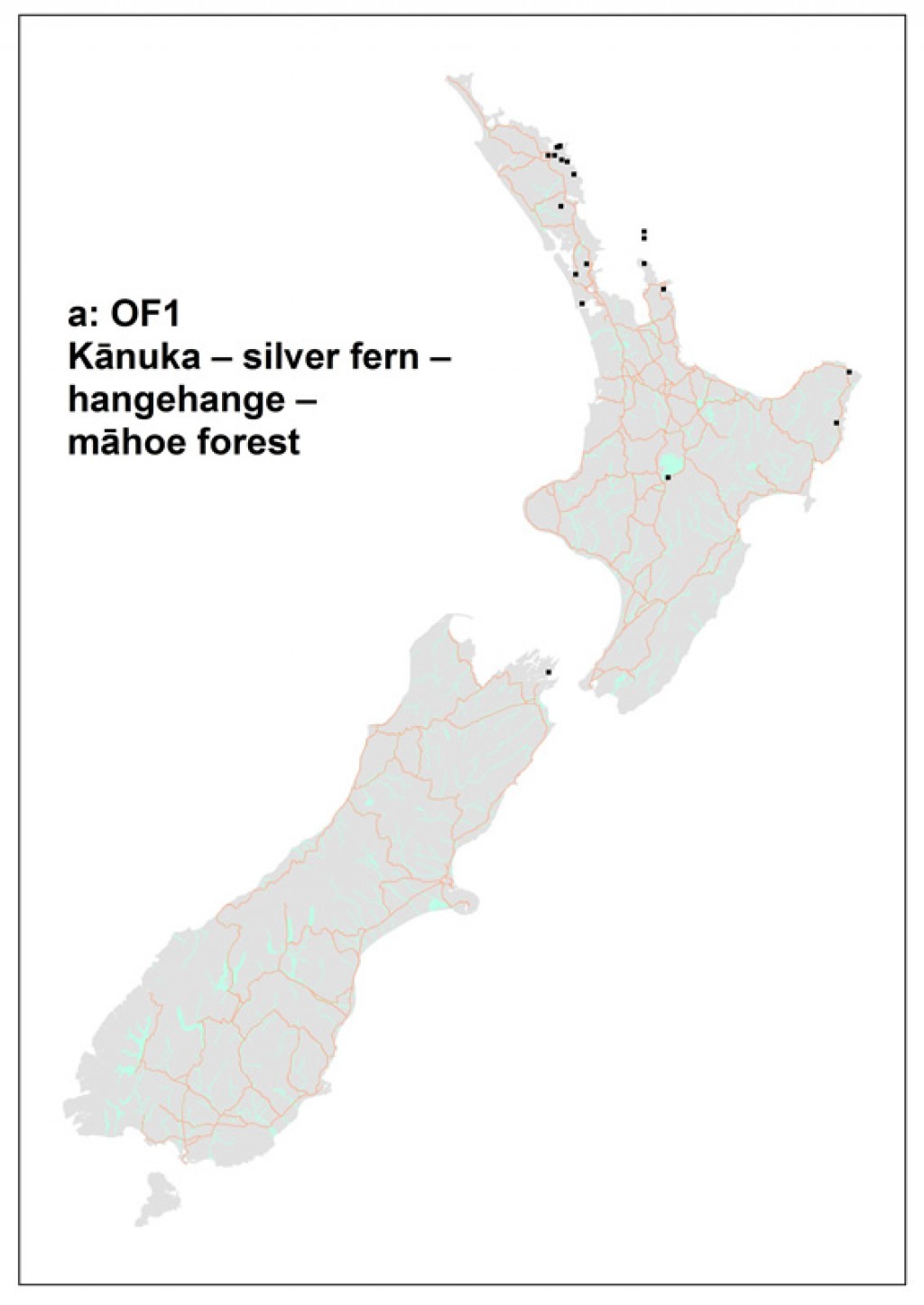
Code: a: OF1
Where does it occur?
This 98 300 ha association has been sampled largely from sites north of Auckland but also from sites in East Cape, Lake Taupo & the Marlborough Sounds. Sites range from shallow (10º) to steeply sloping (40º). Altitudes range from near sea level to 420 m.
Description
This short-statured forest association has an average height of 10 m (range 6 to 15 m) and tends to be species rich with, on average, 37 species on a plot, which can reach as many as 59.On average, 7% of species in this association are exotic.
![[Kunzea ericoides], [Cyathea dealbata] and [Melicytus ramiflorus] are characteristic of the canopy of stands of this association. Abel Tasman National Park. Image](/assets/Publications/Woody-ecosystem-types/Kunzea_ericoides_Cyathea_dealbata_Melicytus_ramiflorus__ScaleWidthWzEwMjRd.jpg)
![[Kunzea ericoides] and [Cyathea dealbata] in the canopy of a stand of this association. [Ulex europeaus] (in flower) occurs very rarely in these stands. Abel Tasman National Park. Image](/assets/Publications/Woody-ecosystem-types/Kunzea_ericoides_Cyathea_dealbata__ScaleWidthWzEwMjRd.jpg)
![[Geniostoma ruprestre] and [Leucopogon fasciculatus] in front of [Cyathea dealbata] in a stand of this association. Abel Tasman National Park. Image](/assets/Publications/Woody-ecosystem-types/Geniostoma_ruprestre_Leucopogon_fasciculatus__ScaleWidthWzEwMjRd.jpg)
![[Leucopogon fasciculatus], [Geniostoma ruprestre] and [Melicytus ramiflorus] in a stand of this association. Abel Tasman National Park. Image](/assets/Publications/Woody-ecosystem-types/Leucopogon_fasciculatus_Geniostoma_ruprestre_Melicytus_ramiflorus__ScaleWidthWzEwMjRd.jpg)
References
Wiser, S.K., Hurst, J.M. 2010. Composition and structure of 24 New Zealand forest and shrubland vegetation communities. Landcare Research Contract Report LC0910-073. Prepared for the Department of Conservation and the Sustainable Management Fund of the Ministry of Agriculture and Forestry.
Wiser, S.K., J.M. Hurst, R.B. Allen, E.F. Wright. 2011. New Zealand’s forest and shrubland communities: a classification based on a nationally representative plot network. Applied Vegetation Science 14: 506-523.
Wiser, S.K.; De Cáceres, M. 2013. Updating vegetation classifications: an example with New Zealand's woody vegetation. Journal of Vegetation Science 24: 80-93.
De Cáceres M, Legendre P, Wiser SK, Brotons L (2012) Using species combinations in indicator value analyses. Methods in Ecology and Evolution 3(6): 973-982.