Predicting soil classes for S-map by modelling tephra depth – preliminary investigation
Mapping tephra extent
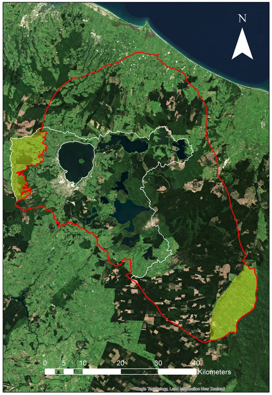
Preliminary work conducted in 2021 in the Rotorua Lakes area identified 3 main tephras (volcanic ash layers) that accounted for most of the soil types within the survey area: Tarawera (1886), Kaharoa (~ 1314 AD), and Taupo (~232 AD). A fourth tephra – the Whakatane – is found within soil profiles beneath the Taupo tephra in the north of the mapping area. Based on the reconnaissance survey of the wider Rotorua Lakes area, the extent of different tephras in the region was broadly defined. Figure 1 illustrates the extent of the Kaharoa tephra (greater than 15 cm depth), covering an area of approximately 300,000 hectares. It can be difficult to see tephra less than 15cm deep in topsoil layers. This tephra provides the best mapping extent using a tephra modelling approach (Fig. 1) in the northern BOP as the Kaharoa tephra layer indicates the boundary between Pumice Soils and Allophanic Soils. Beyond this extent tephra depth is not well correlated with specific NZSC groups.

Figure 1. Approximate DSM predicted extent (red line) of the Kaharoa tephra (> 15 cm depth) in the BOP Region. Yellow shaded area to the west of Lake Rotorua is the Mamaku Plateau DSM (BOP Region only) uploaded to S-map in August 2022. Yellow shaded area in the south-east is the Galatea Basin which will be mapped separately. The white line is the Rotorua Lakes catchment boundary. Mount Tarawera, the source of the Tarawera and Kaharoa tephras, is located to the southeast of Lake Tarawera (centre of the image).
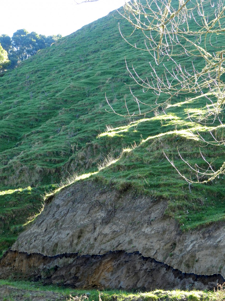
Previously on the Mamaku Plateau, and elsewhere in the Waikato Region, soil map units have been predicted using a random forests (RF) modelling approach. For this project, it was decided to test modelling the depths and distribution of the Tarawera (including Rotomahana mud, see Fig. 2), Kaharoa, and Taupo tephras. This is key information for mapping of the soil pattern, as soils in a location may be formed in either one ‘thick layer’ of a single tephra, or in a ’stack’ of two or more different tephra layers. Both RF and boosted regression tree modelling approaches are being compared using a variety of land-environment covariate data layers, to identify what are the important determinants of soil-landscape relationships. Co-variates being tested include terrain data, such as slope and elevation, as well as tephra-specific data layers such as tephra isopach layers generated from previously published tephra data. Additional tephra depth data will be collected as part of the field survey. Models will be compared by withholding 30% of the field observation data (measured tephra depths) for validation assessment of model performance. The model output will be individual layers for each tephra showing a continuous distribution depth across the landscape. These layers will then be “stacked” in order of deposition age. The spatial extent of individual soil mapping units will be defined using a rule-based GIS model to “build” individual soil classes according to the modelled depth of tephra, and the soil development criteria utilised by the NZSC. Samples collected and analysed for P-retention, particle-size distribution, and percentage stones will be used to better characterise soils within each mapping unit.
Soils associated with the tephra pattern
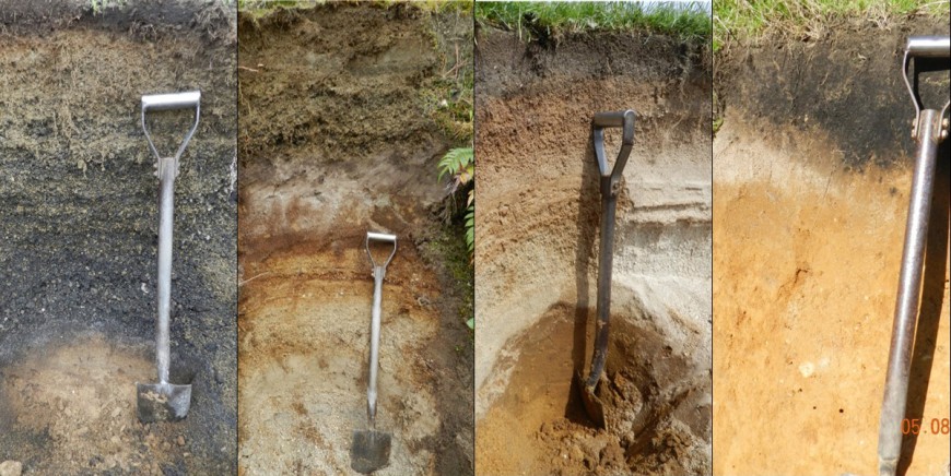
The preliminary soil mapping shows the area is dominated by Recent and Pumice Soils (Fig. 3). Close to the source of both the Tarawera and the Kaharoa volcanic eruptions, the landscape is dominated by deep Tarawera tephra or Rotomohana mud, which are classified as Typic Tephric Recent Soils. However, where the Tarawera tephra or Rotomahana mud are less than 60 centimetres deep, and are underlain by Kaharoa or Taupo pumice, they are classified as Buried-pumice Tephric Recent Soils. Where the Tarawera tephra is less than 25 cm deep and Kaharoa and Taupo tephras extend to deeper than 60 cm, soils are classified as Typic Orthic Pumice or Immature Orthic Pumice Soils. In the north of the mapping area, there are areas with little or no Tarawera tephra and less than 60 centimetres combined depth of Kaharoa and Taupo pumice. In these areas, allophanic Whakatane tephra forms the lower part of the soil profile and Buried-allophanic Orthic Pumice Soils are dominant in the landscape.

Figure 3. Soils found in the mapping area from left to right: (i) Typic Tephric Recent Soil developed in deep Tarawera tephra; (ii) Buried-pumice Tephric Recent Soil with Tarawera tephra over Kaharoa tephra; (iii) Buried-allophanic Orthic Pumice Soil with Kaharoa tephra over Whakatane tephra; and (iv) Vitric Orthic Allophanic Soil developed in Whakatane tephra with shallow Kaharoa tephra to just below the topsoil. The boundary between these last 2 soils will define the boundary of the new DSM map in the northern extent of the survey area.


