These soil surveys were intended to support better land-use planning and improve soil management. However they have been under-utilized, being neither easy to obtain, nor easily interpreted, by residing in government hard copy data, soil reports, and scientific publications. At the same time, a key issue is the urgent need to improve awareness among the Pacific farmers about soils, soil fertility, and soil management practices and how these might relate to traditional knowledge and practices to help evolve best farm management practices that are climate change smart.
 map page of the Pacific Soils Portal")
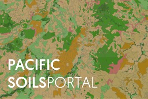
Fig 1. Screenshot of the Savai’i (Samoa) map page of the Pacific Soils Portal
A key component of raising awareness of Pacific soils has been to make the existing legacy soil surveys, integrated with interpretive land resource information, more readily available via websites (rather than physical maps and reports) to farmers, government extension officers, agri-businesses, government policy analysts, and other decision makers.
Funded by the Australian Centre for International Agricultural Research (ACIAR) and developed as part of the “Soil management in Pacific Islands: investigating nutrient cycling and development of the soils portal” project led by CSIRO, the Pacific Soils Portal (https://psp.landcarereasearch.co.nz) uses cloud data centres to overcome infrastructure barriers in national agencies and takes advantage of open-source geospatial software and resources to deliver soils knowledge on-line. The best available published soil maps for five Pacific Island countries (Fiji, Kiribati, Samoa, Tonga, and Tuvalu) have been digitized and combined with a database containing published interpretive information relating to soil classification, soil properties, and crop suitability (mostly prepared by Dave Leslie). The maps are published online as standards compliant web services (e.g. ISO 19128:2005) via a responsive browser-based web site that can be accessed from computer, tablet or smartphone. Currently, over 400 soil profile descriptions and associated soil properties are also published. The interpretive knowledge for both mapped soil polygons and detailed soil profile reports are created on-the-fly using a custom report generation tool.
The Pacific Soils Portal was ’soft launched’ for the Pacific Week of Agriculture in Samoa in October 2019 and subsequently revised and launched publicly in October 2020. Since the soft launch, some 1,650 users of soils data have conducted 3,850 sessions, viewed 23,500 pages, and have spent an average of 7.5 minutes per session exploring data and ancillary information. While these total user numbers are modest by international standards for web site use, they represent a huge increase in users accessing these soils data, and the session duration and other engagement metrics are greater than or equal to those for S-map Online.
A governance group has been established, led by representatives of the five countries and supported by Manaaki Whenua – Landcare Research, CSIRO in Australia, and The Pacific Community (https://www.spc.int ). The governance group are evaluating hosting and funding options to ensure long-term sustainability beyond the scope of a 2nd phase of ACIAR funding due to commence late in 2021.