The upper catchments of the Tinui and Whareama Rivers were added to S-Map this year. This area extends over some 26,000 hectares of hilly and steep country, largely on soft mudstone parent materials. The new mapping abuts existing S-Map coverage to the west and south, added in last year’s update (Fig. 1).
. Areas shaded dark grey have previously been added to S-Map.")
Figure 1: Location and extent of the new mapping (outlined in red). Areas shaded dark grey have previously been added to S-Map.
Field work was completed in late 2020 and early 2021, with 114 full morphological soil descriptions made along with many more brief observations. Of sites, 42% were chosen by a fuzzy k-means clustering model based on primary and secondary terrain attributes, stratified by parent material (simplified geological mapping); the rest were manually selected to supplement the model-based sampling, or otherwise to compensate for land-access restrictions.

Figure 2: Comparison of Fundamental Soils Layer with new S-Map linework. This 2 × 1-km section of the upper Whareama River floodplain contains a number of features that were not previously delineated, including remnant Pleistocene-age alluvial terraces, more recently deposited fans, and areas of contrasting slope.
The mapping is also informed by existing data sources, in particular LiDAR-based elevation data, satellite imagery, geological mapping, farm-scale Land Use Capability (LUC) mapping, and the Fundamental Soil Layers (FSL) dataset. The highly detailed elevation data are particularly useful in supporting delineation of smaller, more precise mapping units compared with the FSL, especially in alluvial areas (Fig. 2). However, most hillslope map units remain relatively large, as the expected scale of soil variation on these slopes is far more local than the target map scale of 1:50,000.
Soil Mapping Units (SMUs) were defined by their major soil siblings (up to five siblings can be assigned to an SMU). SMUs also contain information about the prevailing slope and landscape position associated with each sibling, as determined by fieldwork and pedologist expertise.
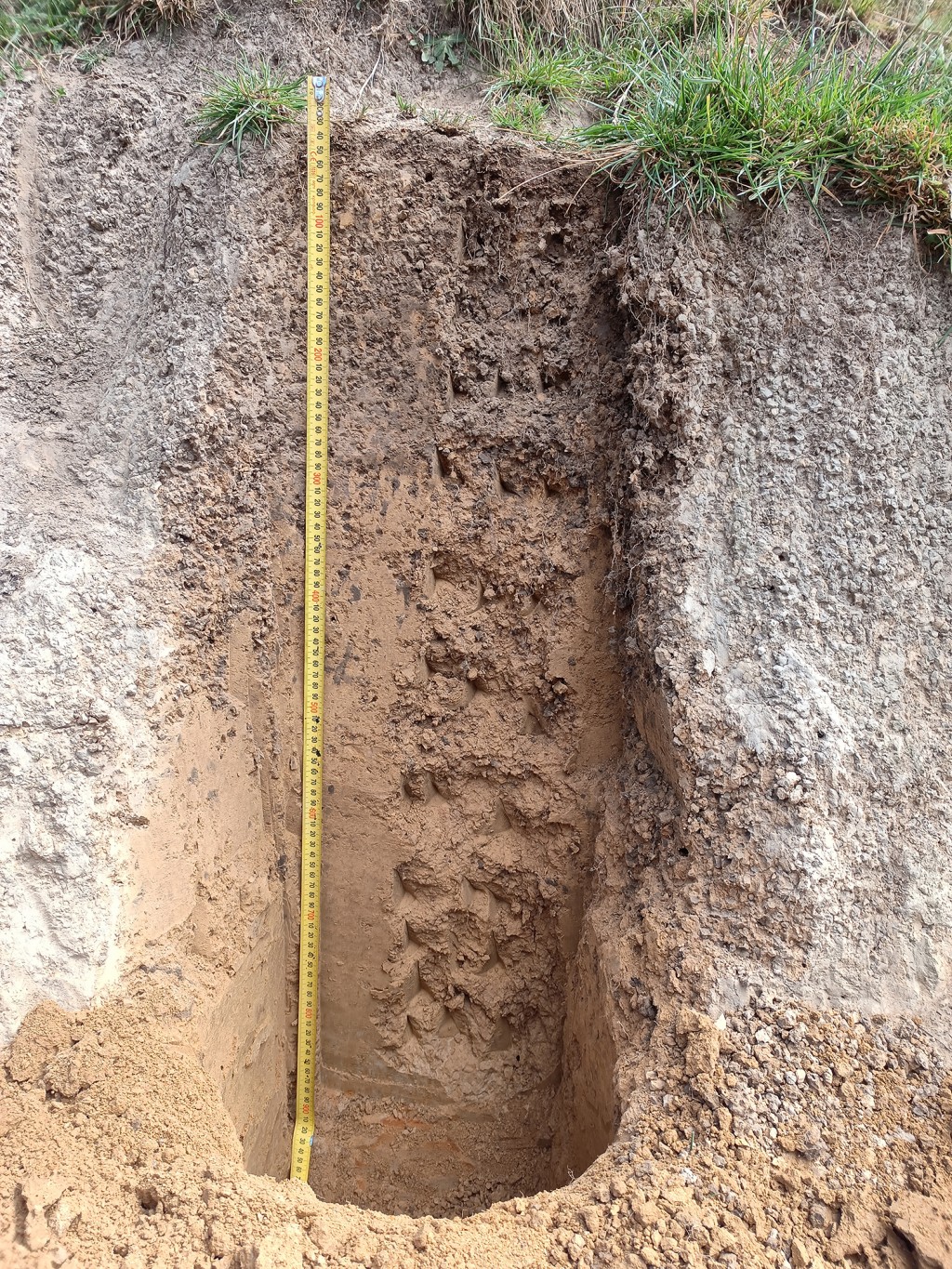
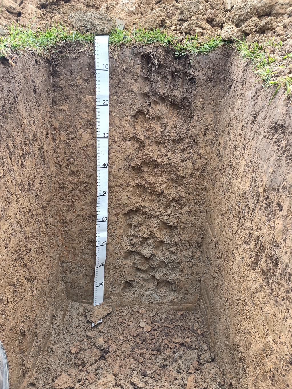
Soils identified were dominated by Orthic Browns, Orthic Gleys and Immature Pallics that occur in close association on the hillslopes dominating the study area (Fig. 3). Alluvial deposits were largely Fluvial Recents and Gleys. Some Firm Brown soils were encountered on stable hillslope positions, but these are spatially restricted. Most soils observed were stoneless, with the notable exception of the greywacke-argillite dominated areas in the south-west of the study area. Clay subsoils are prevalent, but most surface soils are loamy or silty, extending to a depth of 15–35 cm. Deep earthworm burrows are commonly seen beneath the surface layers, forming mixed A/B horizons. Underlying parent material is rarely encountered within 1 m of the land surface on back- or foot-slopes but can often be observed from 0.8 m depth in steeper shoulder and ridge positions.
Figure 3: Examples of progressively wetter soils on hillslopes.
In this area, soil heterogeneity at a broad scale is less pronounced than the variety of landscapes encountered might imply. We attribute this to the relatively young soil age: while the parent materials come from geological formations more than 5 million years old, soil profile development is theorised to be constrained by high rates of downslope creep, high relief, and moderately high rainfall with strong seasonal variability.
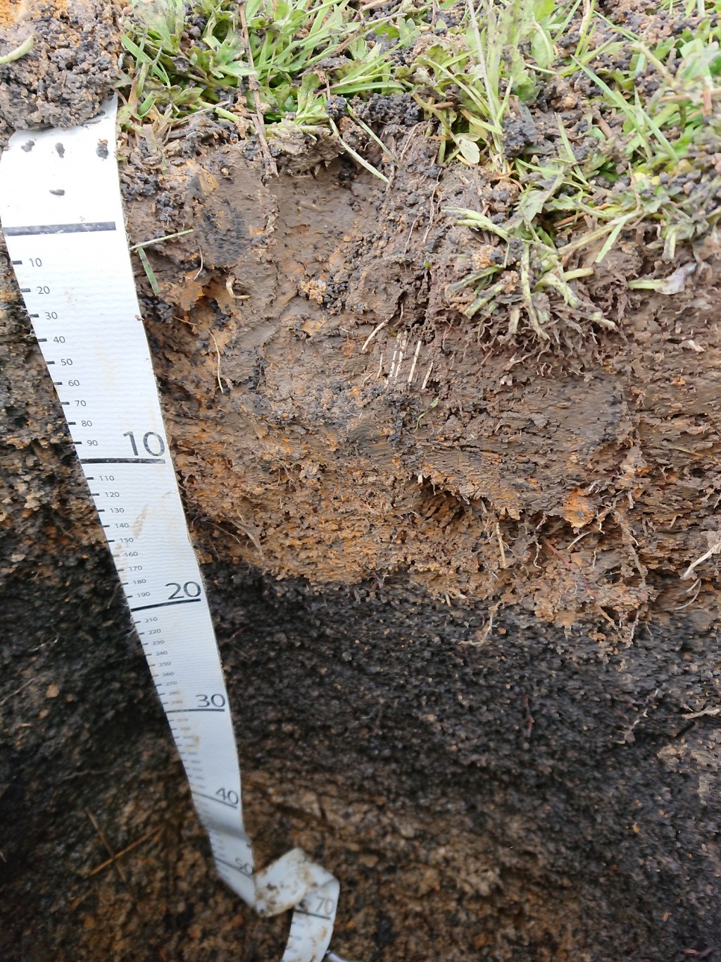
Soil heterogeneity was most apparent over short distances and is theorised to be driven largely by surface water behaviour, degree of erosion, and degree of exposure to prevailing weather. Soil horizonation is inherently unpredictable in areas that have slipped, but A horizon re-establishment was observed on most slips.
Field pH testing indicated naturally acidic conditions throughout soil profiles in many parts of the study area (pH 5.0 - 6.0). Only one alkaline soil profile was encountered, with significant secondary carbonate throughout. These soils may occur rarely within the study area, associated with limestone outcrops, but are too uncommon and spatially restricted to be mapped at the target scale.