
Fig. 1. Kānuka, poplars, and willows on slopes at a farm in the Wairarapa study area.
We addressed this gap in data and knowledge by mapping and classifying trees using Light Detection and Ranging (LiDAR) data in combination with regional orthophotography (2010–2017) across an 840 km2 study area in the Wairarapa. First, we delineated individual tree crowns (ITCs) using an algorithm called pycrown. Next, tree height and crown area were derived from LiDAR data for each of the 840,000 tree crowns in pastoral land, and spectral variables were calculated using freely available high resolution multi-spectral aerial photography flown in 2010, 2013/14 and 2016/17 for Greater Wellington Regional Council. Together, these data for individual tree were used as predictors in a support vector machine model to classify crowns into dominant tree genera (poplar/willow, eucalyptus, conifer, mānuka/kānuka). The resulting rural tree classification achieved an overall accuracy of 92.6% based on 9,200 trees that were ground truthed at two farms within the study area.
We then tested whether the mechanical and hydrological mechanisms by which trees increase slope stability can be empirically verified through observations in landscape-scale data. This was done by assessing the spatial relationship between individual trees and landslide erosion to quantify the fraction of soil eroded as a function of distance from tree using 43,000 landslide scars and 86,000 widely spaced (>15 m apart) trees on slopes (> 17.5°). The resulting curves reflect the average influence an individual tree exerts on slope stability (0–1) for different tree genera (Fig. 2). These tree influence models largely agree with the shape and distribution of existing root reinforcement models derived from previous root excavation work and in-situ pull-out tests.
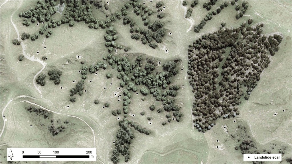
; and untreated pastoral hill country. B: Regional multispectral orthophotos (2010) showing land-slide scars mapped in imagery. Red frame in B shows the extent of Insert C.")
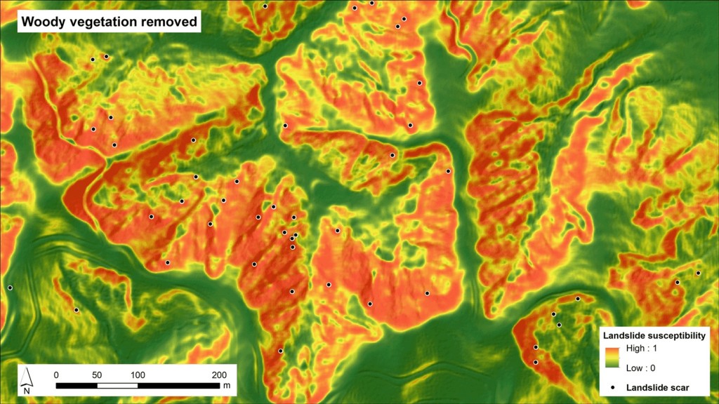
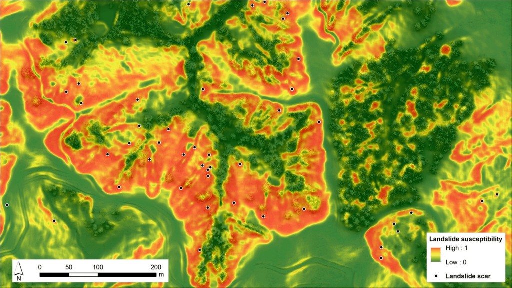
Fig. 2. A: Tree influence models on slope stability for the four genera: conifer, eucalyptus, poplar/willow and kānuka; non-susceptible pastoral land (defined by slope threshold of 17.5°); and untreated pastoral hill country. B: Regional multispectral orthophotos (2010) showing land-slide scars mapped in imagery. Red frame in B shows the extent of Insert C.
Of exotic species that were planted for erosion and sediment control, poplars (Populus spp.) and willows (Salix spp.) make up 51% in pastoral hill country at a mean density of 3.2 trees/ha. This large number of poplars and willows reflects the efforts of landowners and soil conservators over several decades to mitigate erosion processes and adopt more sustainable land management practices. In line with previous studies, poplars and willows have the greatest contribution to slope stability with an average maximum effective distance of 20 m. However, native kānuka (Kunzea spp.) is the most abundant tree species in pastoral hill country within the study area, providing an important soil conservation function. Kānuka commonly grows in dense groves, with an average of 24.1 stems per ha (sph).
A large proportion (56% or 212.5 km2) of pastoral hill-country in the study area remains untreated. The tree influence models presented in this study can be integrated into landslide susceptibility modelling in silvopastoral/agroforestry landscapes both to quantify the reduction in shallow landslide susceptibility achieved and support targeted erosion and sediment mitigation plans (Fig. 3).
Further reading
Spiekermann RI, McColl S, Fuller I, Dymond J, Burkitt L, Smith HG 2021. Quantifying the influence of individual trees on slope stability at landscape scale. Journal of Environmental Management 286: 112194. https://doi.org/10.1016/j.jenvman.2021.112194.