This work will be invaluable for local and central government agencies that monitor wetlands to understand how the vegetation at sites they administer fit into the national context, and to be able to pick up changes in nutrients in the wetland vegetation.
The project builds on work by Susan Wiser and colleagues who classified the vegetation of Aotearoa New Zealand, but found little data on wetland communities.
To remedy this, the first step was to prioritise sampling. Robbie Price undertook a spatial assessment of data representation across the country by climatic zone using existing data sourced from councils, the Department of Conservation, and a remotely-sensed spatial layer of wetland extent. He found several areas that had plenty of wetlands, but no plot data. In response, the wetlands team selected the eastern South Island and central mountain area of Aotearoa to prioritise for gathering extra data and undertook two field trips in early 2022.
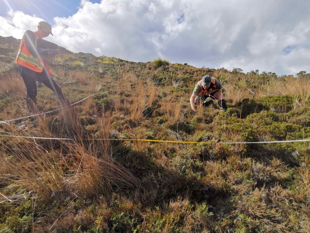
A team comprising researchers Bev Clarkson, Scott Bartlam, Alex Fergus, and Olivia Burge, worked from Dunedin to Christchurch on the eastern side of the Southern Alps for the first trip. “We had big days and lots of logistics – doing plots in multiple wetlands each day, lots of driving between sites, making sure to arrive in rural towns early enough to find dinner still available, then do wetland record sheets and prep gear in the evenings,” says Dr Burge. “This trip was valuable as it brought our Hamilton and Lincoln wetland ecologists together to share best practice and expertise.”
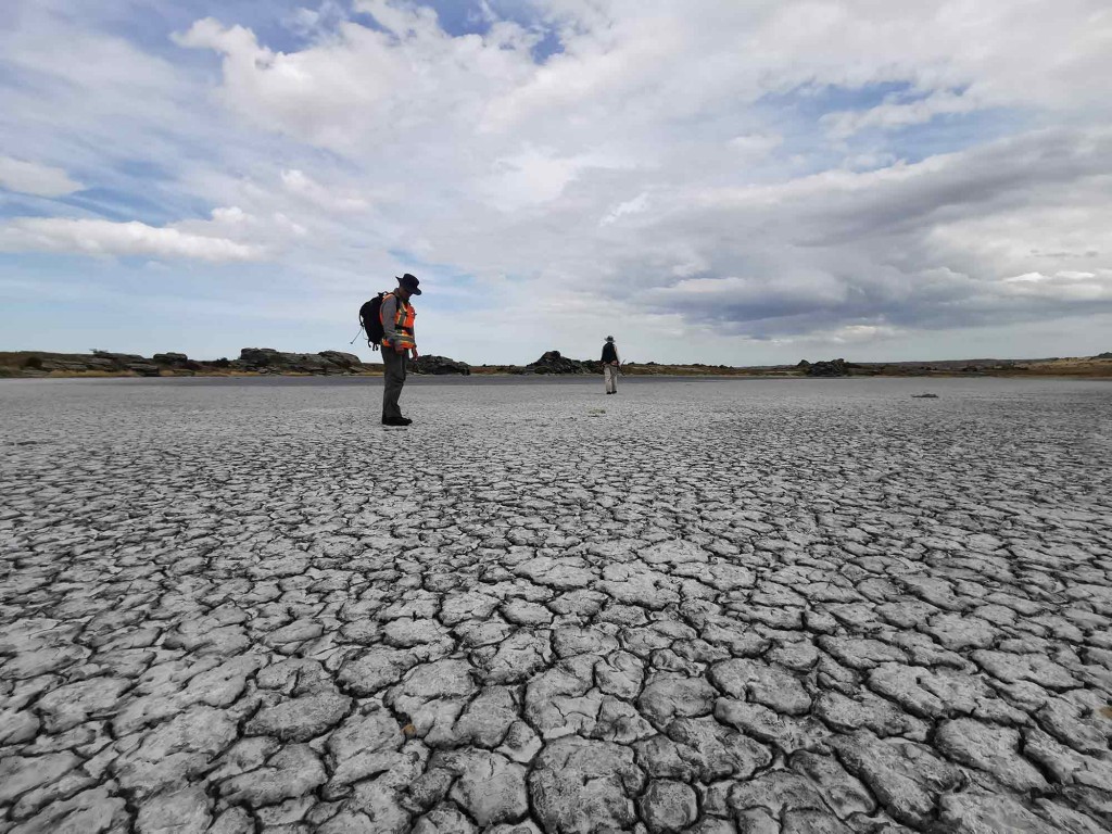
The second trip happened during the Omicron outbreak, so ecologists Gretchen Brownstein and James Arbuckle from Manaaki Whenua’s Dunedin site joined the team, instead of the Hamilton staff. This trip involved travelling to wetlands that were more remote than the first, and had fewer non-native species. Sampling pristine, remote wetlands is vital to build an understanding of ‘reference’ conditions, against which councils can judge human impacts in any wetlands they monitor.
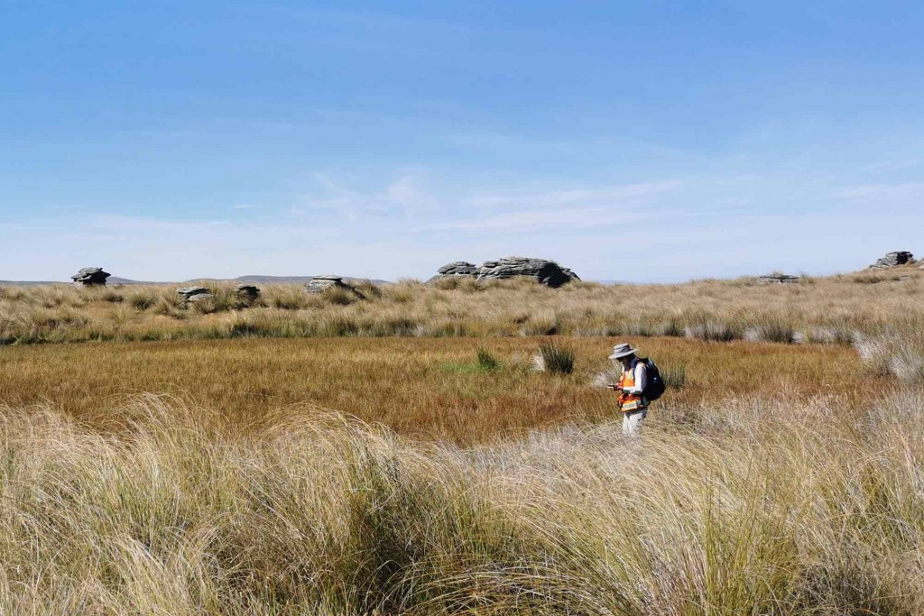
For researcher Bev Clarkson, collecting the new South Island data has been a great chance to compare North Island wetlands, in which she has done extensive work and eastern South Island wetlands. “‘Wetland types and typical ’indicator’ species in eastern South Island and northern North Island (Waikato) revealed many similarities, such as swamps with Carex secta, and salt marshes with oioi (Apodasmia similis).
“However, there were some notable contrasts - the large, raised lowland bogs characteristic of the Waikato, areas such as Kopuatai, were absent. Instead on our trip we found a wider range of fens, inland saline and ephemeral wetlands, some with especially fascinating turf communities containing threatened species, including Gratiola concinna (formerly known as G. nana).”
Dr Burge adds that the team has previously tried to calculate national ‘thresholds’ for human impact in terms of nitrogen and phosphorus but did not have enough data from pristine wetlands to establish a baseline, despite this being a highly sought-after metric for councils. “The next step for the project is to calculate how many extra sampling plots are needed to create a full picture of wetland reference conditions, after the data from this trip are analysed,” she says.
Wetland classification fieldwork
![[Empodisma], a rush-like herbaceous plant, at Thousand Acre Plateau Image](/assets/Publications/Putaiao/Putaiao-Issue-10/empodisma-on-gley-soils-thousand-acre-plateau__ScaleWidthWzEwMjRd.jpg)
![Wetland near Oamarama dominated by [Carex secta] Image](/assets/Publications/Putaiao/Putaiao-Issue-10/wetland-near-Oamarama-dominated-by-carex-secta__ScaleWidthWzEwMjRd.jpg)