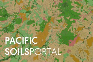
Soil map of Fiji showing land use capability classes
Developed by Manaaki Whenua in collaboration with CSIRO Agriculture and Food, the Secretariat of the Pacific Communities Land Resources Division, and PICT Agriculture Departments, the portal brings together soil data for five Pacific countries, some of which dates back to the 1960s.
“The portal is a major milestone for agricultural extension officers, land users, and decision-makers,” says Manaaki Whenua project lead James Barringer. “Individual users can access location-specific interpretive knowledge of soil properties and find out whether a soil is generally suited to a proposed agricultural use, and what soil limitations are likely to require management, all at the click of a button.”
The PSP currently covers Fiji, Samoa, Tonga, Kiribati and Tuvalu and will also link to the New Zealand and Australia portals to showcase and compare soils across the entire South Pacific. It will also align with activities under the FAO’s Global Soil Partnership.
The PSP is a component of the Soil Management in the Pacific Islands project funded by the Australian Centre for International Agricultural Research (ACIAR), and can be viewed on computers, tablets and smart phones.