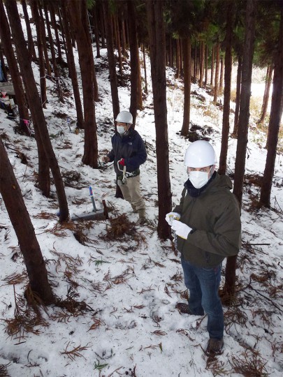
Forest monitoring site - Hugh Smith, front and Prof Yuichi Onda, programme lead, behind.
Published as Japan was marking the 10th anniversary of the event, the review sheds greater lighter on the fate of radioactive fallout, particularly Cesium-137 and Cesium-134, in terrestrial environments, including forest, agricultural and urban areas, movement into the soil, and transport through rivers to the ocean.
Geomorphologist Dr Hugh Smith was invited to join the study by programme lead Prof Yuichi Onda shortly after the deadly March 2011 disaster, in which the Fukushima No, 1 plant was crippled after being hit by a tsunami caused by a 9.0 magnitude earthquake. It was the world’s second worst nuclear accident after Chernobyl.
“At the time there was no information available about the movement of radiocesium fallout from the land to rivers and the ocean,” says Dr Smith. The first six continuous monitoring stations to measure this were set up in June 2011 with a further 24 stations installed by October 2012 within the Abukuma River catchment, as well as other rivers draining the coastal catchments of the Hamadori district.
“The stations were located in heavily contaminated areas and designed to monitor radiocesium attached to sediment that was washed into rivers from a range of sources, including steep forested slopes and flat paddy fields.
“We didn’t know how much radiocesium was going from the land into the rivers, and where it was going from here.”
While most radioactive material released into the atmosphere was blown out to sea, a change in the prevailing winds resulted in fallout across land. The government initiated an immediate evacuation of nearly 160,000 people within 1600km2 around the nuclear plant. As of March 2020, following extensive land remediation efforts including removing the top layer of topsoil across much of the agricultural land in the area, this has been reduced to 330km2.
Because of the steep and mountainous terrain, with rivers flowing short distances to the ocean, the contributions to riverine radiocesium transport made by forested and human-affected areas could be evaluated. “Ten years on, our level of understanding has progressed enormously, including how this event differed from Chernobyl, which has until now always been the reference point,” says Dr Smith.
He adds that the fact we are dealing with relatively long-lived isotopes means this isn’t the end of the story, and remediation efforts will still be needed for decades. “Nuclear power will remain a significant source of power in the future, particularly with growing populations and energy demands,” says Dr Smith. “These data will form the basis for policy and planning in case of future events.”

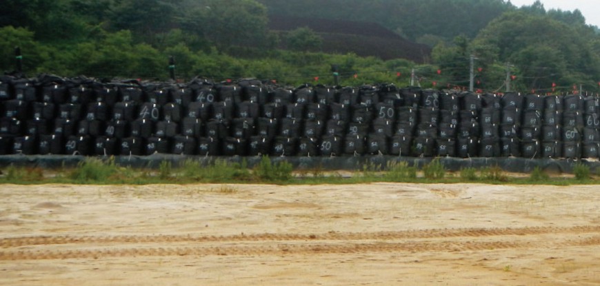
Contaminated soil in storage following decontamination (removal of topsoil)
Key contact

